
Stop guessing the sea margin
Know the expected weather impact before fixing the voyage. For any route, any speed, any time of year: a sea margin from 10 years of recorded weather along the track, matched to the vessel, in the Optimum Voyage Voyage Planner.
Weather is not standard
Every voyage estimate carries a sea margin: the allowance added to calm-water speed or consumption to cover weather and current. In most estimating tools it is a single fixed percentage, applied to every route, every month and every speed.
But weather is not standard. A North Atlantic crossing in January does not carry the same exposure as the same crossing in July. A northern great-circle track and a southern track on the same day meet different seas. A vessel sailing slower spends longer exposed. Route, season, vessel and speed all matter.
The margin decides whether a voyage looks profitable before it is fixed. Set it too low and the estimate promises a speed and consumption the vessel cannot deliver. Set it too high and a good voyage is passed over for one that was never better. Either way, the decision is made on the wrong picture.
Dynamic weather factors replace the generic assumption with a voyage-specific one. The sea margin stops being a fixed number sitting outside the calculation. It becomes part of the calculation itself.
A margin that follows the voyage
Route-specific
Each evaluated route gets its own margin, from the weather and current recorded along that track. A shorter track through rougher water and a longer track through calmer water are compared on what they will actually cost.
Season-specific
Choose the departure date and the margin reflects that month, built from the last ten years of conditions on the track at that time of year. More than 40 terabytes of weather data sit behind it.
Vessel- and speed-specific
The margin is simulated on the vessel's own performance model, in the loading condition and at the speed of each option. Slower profiles see more weather; the margin says by how much.
Same voyage, same month, eleven routes
In this evaluation the eleven routes considered carried sea margins from 5.0% to 11.4%. The shorter northern tracks needed roughly twice the allowance of the longer southern ones. Two estimates built on the same fixed margin would have ranked those routes the wrong way round.
Four steps to a voyage-specific margin
Describe the voyage
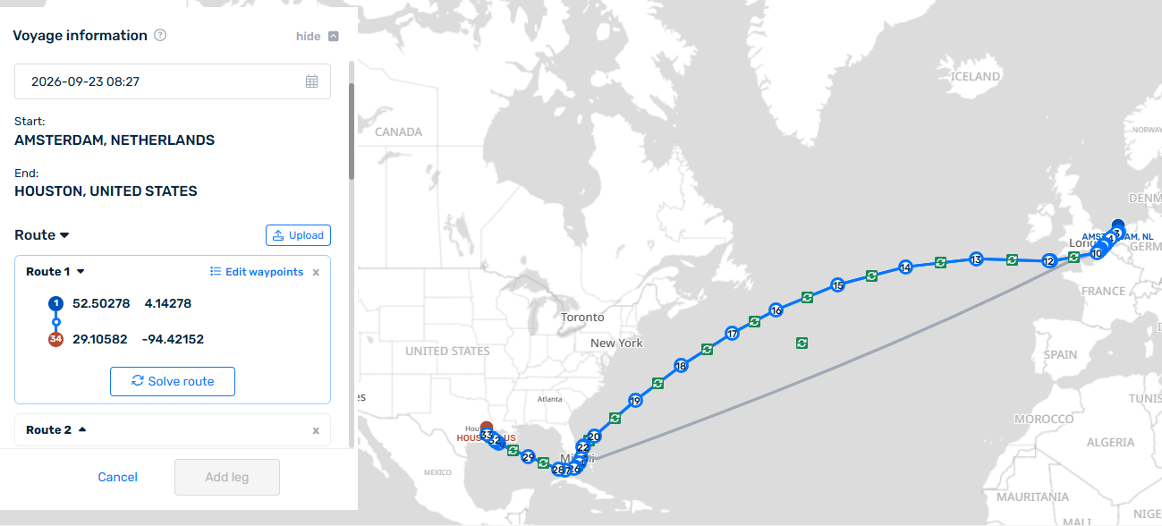
Vessel, departure time, start and end port. Solve the route on the map, upload an RTZ, or route from the vessel's latest known position. Add more routes to compare.
Set the condition and the costs
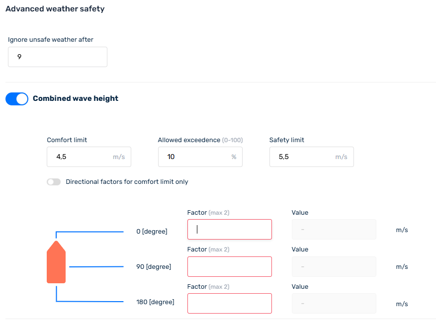
Laden or ballast and drafts, the optimization objective, cost of time and fuel prices for ECA and non-ECA. All of it can be refined later.
Evaluate the routes
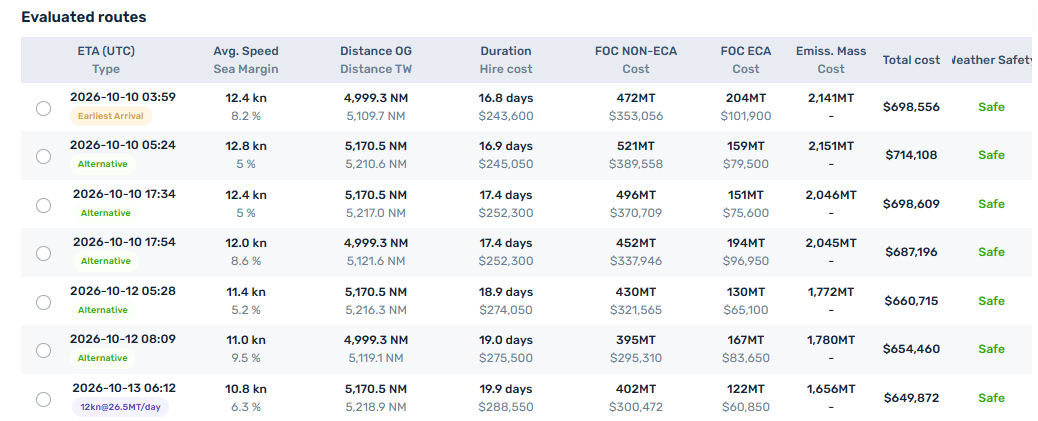
The planner returns the options within about a minute: ETA, average speed, sea margin, distance over ground and through water, duration, hire cost, fuel consumption and cost inside and outside ECA, emissions and weather safety, for each route and arrival option.
Choose and carry it into the plan
Open any option to see costs, speed profile, weather along the track and waypoints. Select it for the leg and the margin, costs and ETA carry into the voyage plan, ready for the next leg or for sharing.
Built for the decisions before the voyage
Pre-fixture estimates
Compare candidate voyages on margins that match the season and the track, before committing to a rate.
TCE and budgeting
Duration and consumption in the estimate reflect the weather the vessel will meet, so the earnings figure holds up after the voyage.
Charterparty negotiation
Know what speed and consumption the vessel can realistically warrant on that route in that month.
Fleet planning
Evaluate several voyages for one vessel, or one voyage for several vessels, on the same basis.
The objective is not to predict the exact weather weeks or months ahead. It is to replace an arbitrary allowance with a far stronger statistical basis.
From historical expectation to live optimization
Dynamic weather factors set a realistic expectation before the voyage. As departure approaches, Optimum Voyage moves from historical weather analysis to forecast-based optimization, and the information becomes progressively more specific.
What should we reasonably expect on this route, at this time of year, at this speed?
What conditions are we actually expecting now, and what is the best route and speed through them?
Daily re-optimization keeps that answer current for the whole voyage.
Questions
What is a sea margin?
The allowance added to a vessel's calm-water speed or consumption in a voyage estimate to cover the effect of weather and current over the passage. Most estimating tools apply one fixed percentage to every voyage.
How is the dynamic sea margin calculated?
For each evaluated route and speed profile, the Voyage Planner simulates the vessel over the weather and current conditions recorded along that track in the same season across the last ten years, using the vessel's own performance model, and expresses the result as a percentage against calm water.
Is it available in the API?
Dynamic weather factors are available now in the portal Voyage Planner for managed-service clients. API access is planned; contact us if you need it for an integration.
Does it replace weather routing?
No. It sets the right expectation before the voyage is fixed. Once the vessel sails, daily weather routing and re-optimization work on the live forecast.
Any route. Any time of year. A sea margin based on the voyage, not a default percentage.
Send us the ports and the intended departure window and we will run the evaluation for you, with the sea margin for each option.
Available now to all managed-service clients in the portal, at no additional cost.